Version Française Profil LinkedIn

Here you will find every website, media, documents you will need to prepare your flights. If you want me to add something, just drop me an e-mail!


Essentials websites to fly in France


SIA Website: Essential to prepare flights in France
On this Website are available:
-NOTAMs (Airfields + Enroute) and the SUP AIP (Complements)
-Low altitude and High Speed Aeras (Fighters)
-Airfields Charts
-En route charts, Low and High Level
-Regulations
-Charts to order
-And a lot of interesting things...


OLIVIA: No, its not a dating Website
Here are available:
-NOTAMs for Airfields and enroute
-Accurate weather charts, and wind charts
-Online flight planning
For the Weather section, a code is required, type 0000, it works...


AEROWEB: This is provided by Meteo France, but specificly for aviation. I've put it here because I think it is relevant to get the essential informations to prepare your flight. There are a lot of others, but the regulation does not force you to use one in particular.
Here you will find:
-Analysis and forecast chart, essentiel to understand the global situation and how it moves
-Weather and wind charts, at different scales (France, Europe, and other)
-Available METARS and TAFS for the required airports
-Interesting stuff about lightning, rainfalls... You have to create an account, which is free. It allows you to save your searches.

Relevant medias


EARTH: A very interesting site, which models the worldwide airstreams
Several features are available:
-Differents altitudes
-The air temperature
-Water temperatures
-A lot of good stuff!


Le Bulletin technique de la chaine météo: No, its not only a simple weather report!
In a very concise summary, the presenter will explain the general aerological situation across the country and europe.
This is in my opinion an excellent site to prepare their briefings.
It allows an understanding of the general dynamics
It shows the evolution of fronts
Aeronautical technical terms are used


Météo60:Forecasts, radar and satellite observations, here is a very technical site
Various functions are acessibles such as:
-The Visualization of precipitations, with the ability to see the evolution of the day with a picture every 15 minutes
-The Lightning strikes
-The ceiling from satellite or radar
-And many other things such as water temperatures, etc ...


CARTE AERO FFA: A nice interactive map, which allows you to trace a navigation
Various functions are acessibles such as (among others):
-The Route of navigation including turning points
-Taking into account the weather
-Ability to change the speed plane, to view METAR/TAFs
-Display of VAC cards


SKY VECTOR: This is basically the same tool as Aero Carte FFA, but with the entire world, and the ability to draw IFR routes
Various functions are acessibles such as (among others):
-The Route including turning points
-Taking into account the weather
-Ability to change the speed, and to view weather
-Creation of a simple PLOG (turning points, distances, speeds)
-Fuel calculations.


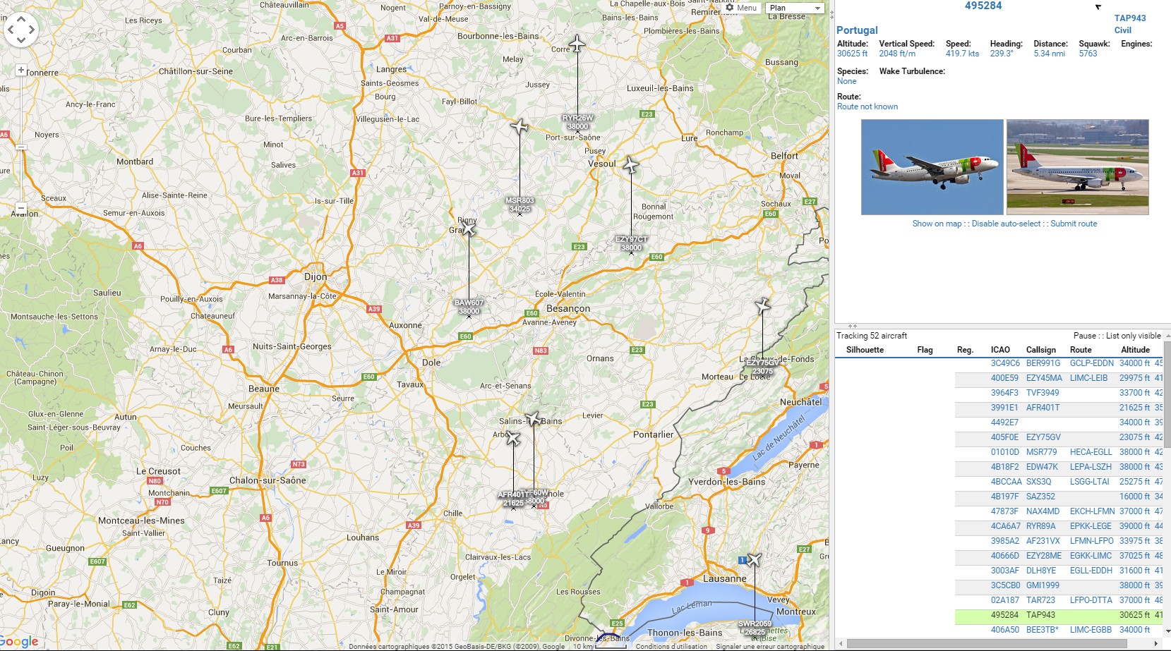
RADAR VIRTUEL: Created by a friend of mine, Laurent DUVAL.
Many other stations like this one as installed over the world.
It allows to receive transpondeur signals, if these are S mode, or ADS-B equipped.
Radar Virtuel allows to follow all planes on your screen...

For pilots, its just a gadget, but for instructors, it can be interesting to know what your student is doing...


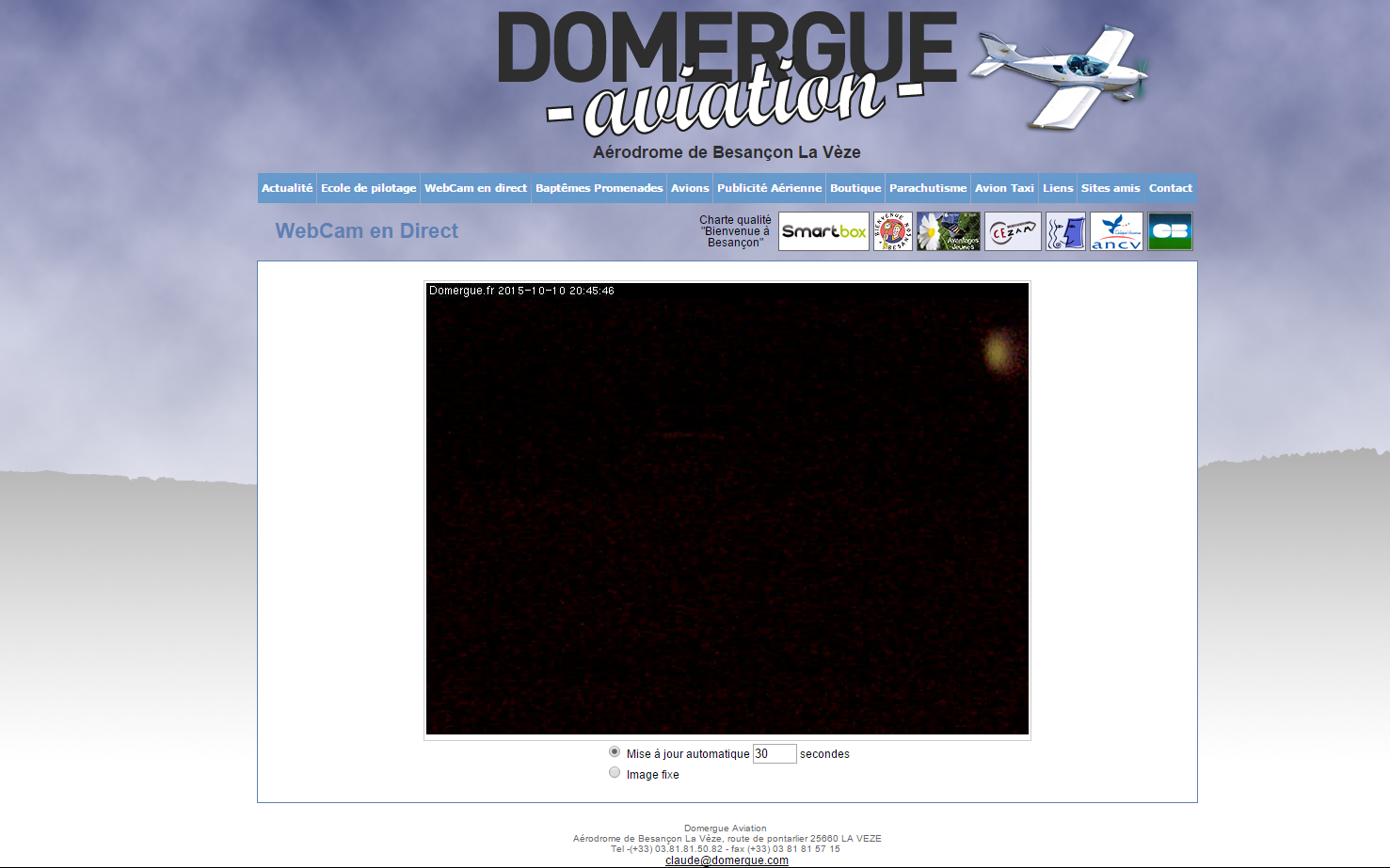
WEBCAM BESANCON LA VEZE: Of course, it s where is was "aeronauticly born"...I had to put this link here!
Veru usefull to have a look on the weather before take the car to go for fly...


Useful documents to plan your flights. This can be completed if you ask me (e-mail), no issue!
Click on the file to display.


Mass and Balance

-PS-28 Sport Cruizer

-Cessna C172


On request of a friend of mine who is FI, I place here the useful sites for the preparation of flights in England.


MET-OFFICE: A very good weather site used by most clubs, schools and companies to prepare their flights.

-The Wind maps / temperature at different times and levels are available
-METARs and TAFs are also present
-The site requires registration, which is free.
English VFR Charts: The equivalent of the French VAC Atlas of SIA, but let's be chauvinistic, underperformed. I have not found better.
IPPC Briefings NOTAMS, TAFs et METARs: Full briefing with TAFs, METARs of selected airfields, and can also display the NOTAMs, on the same page.
Flight planning is available as well but you will need to suscribe fo free.


Chet's Logbook © Chet et pi un peu Pat aussi 2023
--> CONTACT <--